Tudor and Cashel
 From Wikipedia - Reading time: 9 min
Tudor and Cashel | |
|---|---|
| Township of Tudor and Cashel | |
 Municipal office in Gilmour | |
| Coordinates: 44°45′N 77°36′W / 44.750°N 77.600°W | |
| Country | Canada |
| Province | Ontario |
| County | Hastings |
| Incorporated | 1869 |
| Government | |
| • Type | Township under a mayoral-council system |
| • Mayor | Dave Hederson |
| • Federal riding | Hastings—Lennox and Addington |
| • Prov. riding | Hastings—Lennox and Addington |
| Area | |
| • Land | 433.31 km2 (167.30 sq mi) |
| Population (2021)[1] | |
• Total | 740 |
| • Density | 1.7/km2 (4/sq mi) |
| Time zone | UTC-5 (EST) |
| • Summer (DST) | UTC-4 (EDT) |
| Postal Code | K0L 1W0 |
| Area code(s) | 613 and 343 |
| Website | www |
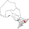
Tudor and Cashel is a township in the Canadian province of Ontario, located in Hastings County.
The township consists of two non-contiguous portions, separated by Limerick township and the northernmost portion of Tweed.The municipality is mostly rural.
History
[edit]Tudor Township was created circa 1865.[2] Cashel Township was created circa 1869.[3] Tudor and Cashel Townships were administered as one in 1897.[4]
Limerick Township and Wollaston Township petitioned unsuccessfully for separation from Tudor Township in 1868.[5] Wollaston Township was eventually formed circa 1880. Limerick Township was eventually formed in 1887 between today's Tudor and Cashel Townships. Geologically Limerick Township and Tudor Township are very similar, with valuable mineral resources.[6]
After the separation of old Limerick Township, the townships of Tudor and Cashel were geographically separated since Limerick abutted along a corner of old Grimsthorpe Township (which was later amalgamated into the Municipality of Tweed).
Communities
[edit]- Gilmour (44°49′01″N 77°37′01″W / 44.817°N 77.617°W)
- Glanmire (44°45′05″N 77°40′55″W / 44.75139°N 77.68194°W), ghost town
- Gunter (44°52′53″N 77°32′40″W / 44.88139°N 77.54444°W)
- Millbridge (44°41.5′N 77°36′W / 44.6917°N 77.600°W), ghost town[7]
- Millbridge Station (44°42′54″N 77°35′56″W / 44.71500°N 77.59889°W), ghost town

Demographics
[edit]In the 2021 Census of Population conducted by Statistics Canada, Tudor and Cashel had a population of 740 living in 352 of its 758 total private dwellings, a change of 26.3% from its 2016 population of 586. With a land area of 433.31 km2 (167.30 sq mi), it had a population density of 1.7/km2 (4.4/sq mi) in 2021.[1]
| 2021 | 2016 | 2011 | |
|---|---|---|---|
| Population | 740 (+26.3% from 2016) | 586 (0.0% from 2011) | 586 (-14.1% from 2006) |
| Land area | 433.31 km2 (167.30 sq mi) | 445.66 km2 (172.07 sq mi) | 445.67 km2 (172.07 sq mi) |
| Population density | 1.7/km2 (4.4/sq mi) | 1.3/km2 (3.4/sq mi) | 1.3/km2 (3.4/sq mi) |
| Median age | 57.2 (M: 57.2, F: 57.6) | 53.0 (M: 52.3, F: 53.7) | |
| Private dwellings | 758 (total) 352 (occupied) | 768 (total) 268 (occupied) | 675 (total) |
| Median household income | $61,600 | $45,952 |
|
|
| |||||||||||||||||||||||||||||||||||||||||||||||||||||||||||||||
| Source: Statistics Canada[1][13][14][15] | |||||||||||||||||||||||||||||||||||||||||||||||||||||||||||||||||
Mother tongue (2021):[1]
- English as first language: 92.6%
- French as first language: 0.7%
- English and French as first language: 0.7%
- Other as first language: 6.1%
See also
[edit]References
[edit]- ^ a b c d e "Tudor and Cashel (Code 3512048) Census Profile". 2021 census. Government of Canada - Statistics Canada. Retrieved 2024-11-03.
- ^ Map of Tudor Township circa 1865 (Creation). Hastings County Historical Society (1957-). Repository: Community Archives of Belleville and Hastings County. Accessed 1 June 2020.
- ^ Map of Cashel Township circa 1869 (Creation). By MacLeod and Carre, P.L.S. (1861-1867). Repository: Community Archives of Belleville and Hastings County. Accessed 31 May 2020.
- ^ Archives of Ontario; Toronto, Ontario, Canada; Collection: MS935; Reel: 83. Accessed via ancestry.com paid subscription 31 May 2020.
- ^ Limerick Township : Petition to separate from Tudor Township 9 December 1868 (Creation). Hastings County Historical Society (1957-). Repository: Community Archives of Belleville and Hastings County. File contains a manuscript report of the Hastings County Council Committee of Whole, 1868, finding against a petition for the separation of Wollaston and Limerick Townships from Tudor Township and the creation of separate township councils. Accessed 1 June 2020.
- ^ Geology of Limerick and Tudor Townships, Hastings County. By S. B. Lumbers. Geological Report 67. Ontario Department of Mines, publ. Toronto, 1969.
- ^ Plan of Millbridge in the Township of Tudor 28 March 1867 (Creation). By Charles Fraser Aylsworth Sr., P.L.S. (1834-1911). Repository: Community Archives of Belleville and Hastings County. Accessed 1 June 2020.
- ^ "2021 Community Profiles". 2021 Canadian census. Statistics Canada. February 4, 2022. Retrieved 2024-11-03.
- ^ "2016 Community Profiles". 2016 Canadian census. Statistics Canada. August 12, 2021. Retrieved 2012-03-02.
- ^ "2011 Community Profiles". 2011 Canadian census. Statistics Canada. March 21, 2019. Retrieved 2012-03-02.
- ^ "2006 Community Profiles". 2006 Canadian census. Statistics Canada. August 20, 2019.
- ^ "2001 Community Profiles". 2001 Canadian census. Statistics Canada. July 18, 2021.
- ^ "Tudor and Cashel census profile". 2011 Census of Population. Statistics Canada. Retrieved 2012-03-02.
- ^ 1996, 2001, 2006 census
- ^ "1971 Census of Canada - Population Census Subdivisions (Historical)". Catalogue 92-702 Vol I, part 1 (Bulletin 1.1-2). Statistics Canada: 76, 139. July 1973.
 KSF
KSF
