Vari
 From Wikipedia - Reading time: 7 min
Vari
Βάρη | |
|---|---|
 | |
| Coordinates: 37°50′N 23°48′E / 37.833°N 23.800°E | |
| Country | Greece |
| Administrative region | Attica |
| Regional unit | East Attica |
| Municipality | Vari-Voula-Vouliagmeni |
| Area | |
| • Municipal unit | 22.633 km2 (8.739 sq mi) |
| Elevation | 25 m (82 ft) |
| Population (2021)[1] | |
| • Municipal unit | 16,717 |
| • Municipal unit density | 740/km2 (1,900/sq mi) |
| Time zone | UTC+2 (EET) |
| • Summer (DST) | UTC+3 (EEST) |
| Postal code | 166 xx |
| Area code(s) | 210 |
| Vehicle registration | Z |
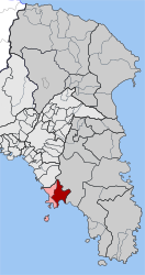
Vari (Greek: Βάρη) is a southern suburb of Athens and former municipality in East Attica, Greece along the Athens coast. The ancient Athenian deme of Anagyrous was situated here.
Since the 2011 local government reform it is part of the municipality Vari-Voula-Vouliagmeni, of which it is a municipal unit.[2] The municipal unit has an area of 22.633 km2.[3]
Geography
[edit]It lies at the southwestern end of the Mesogeia plain and the southeast shoulder of the Hymettus mountain, near the Saronic Gulf coast. Greek National Road 91 connects Vari with Athens city centre and Sounio. Vari's beach is located in an area called Varkiza, a fishing village that joined the municipality of Vari, in 1997. This particular beach has won the blue flag many years in the past, including 2009.
After 1 January 2011 Vari joined Voula and Vouliagmeni, according to Kallikratis regulations, in a joined municipality. Grigoris Konstantellos is the incumbent mayor, elected for a second term at May 26, 2019, for the unified municipality of Vari-Voula-Vouliagmeni.
Archaeology
[edit]A 2,000-year-old marble engraving found near Vari might indicate an Archaic temple on the Acropolis of Athens. It is possible that sheep and goat herders carved the engraving in the 6th century BC. It depicts a temple facade with at least five columns and includes an inscription in Old Attic alphabet referring to the "Hekatompedon" by someone named Mikon. The term ἑκατόμπεδος, meaning "of a hundred feet", has been used in sacred contexts, and the Acropolis is the most likely location due to its association with the term. The engraving could refer to the Bluebeard Temple or the Gigantomachy Temple, both on the Acropolis.[4]
Historical population
[edit]| Year | Population |
|---|---|
| 1981 | 4,211 |
| 1991 | 8,488 |
| 2001 | 10,998 |
| 2011 | 15,855 |
| 2021 | 16,717 |
See also
[edit]References
[edit]- ^ "Αποτελέσματα Απογραφής Πληθυσμού - Κατοικιών 2021, Μόνιμος Πληθυσμός κατά οικισμό" [Results of the 2021 Population - Housing Census, Permanent population by settlement] (in Greek). Hellenic Statistical Authority. 29 March 2024.
- ^ "ΦΕΚ B 1292/2010, Kallikratis reform municipalities" (in Greek). Government Gazette.
- ^ "Population & housing census 2001 (incl. area and average elevation)" (PDF) (in Greek). National Statistical Service of Greece. Archived (PDF) from the original on 2012-12-02.
- ^ Langdon, Merle K.; Rookhuijzen, Jan Z. van (2024-07-01). "Mikon's Hekatompedon: An Architectural Graffito from Attica". American Journal of Archaeology. 128 (3): 433–442. doi:10.1086/729771. ISSN 0002-9114.
External links
[edit]- Official website (in Greek)
 KSF
KSF
