Viña del Mar Airport
 From Wikipedia - Reading time: 6 min
Concón Airport | |||||||||||
|---|---|---|---|---|---|---|---|---|---|---|---|
| Summary | |||||||||||
| Airport type | Military/Public | ||||||||||
| Serves | Greater Valparaíso | ||||||||||
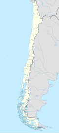
| Location | Concón, Valparaíso | ||||||||||
| Elevation AMSL | 461 ft / 141 m | ||||||||||
| Coordinates | 32°57′00″S 71°28′45″W / 32.95000°S 71.47917°W | ||||||||||
| Map | |||||||||||
 | |||||||||||
| Runways | |||||||||||
| |||||||||||

Concón Airport (IATA: KNA, ICAO: SCVM) is an airport serving Greater Valparaíso, Chile. The airport is in the hills 4 kilometres (2.5 mi) east of the coastal commune of Concón. It mainly serves as a military air base for the Chilean Navy aviation ("Base Aeronaval y Aeropuerto Concón"), but also has a small civilian passenger terminal; this is however only rarely used.
Accidents and incidents
[edit]On 9 September 2013, A Corpflite Dornier 228, registration CC-CNW crashed into power lines while attempting to land in fog, resulting in the loss of both crew members.[4]
See also
[edit]References
[edit]- ^ "Airport information for Viña del Mar Airport". World Aero Data. Archived from the original on 2019-03-05. Data current as of October 2006.
- ^ Airport information for Concón Airport at Great Circle Mapper.
- ^ Google Maps - Vina del Mar
- ^ Corpflite Dornier 228 Crashes On Landing
External links
[edit]- Viña del Mar at OpenStreetMap
- Viña del Mar at OurAirports
- Aeronautical chart and airport information for Vina del Mar at SkyVector
- Accident history for Viña del Mar Airport at Aviation Safety Network
- Current weather for Viña del Mar at NOAA/NWS
Licensed under CC BY-SA 3.0 | Source: https://en.wikipedia.org/wiki/Viña_del_Mar_Airport9 views | Status: cached on April 14 2025 20:36:55↧ Download as ZWI file
 KSF
KSF