Yethonat, Washington
 From Wikipedia - Reading time: 6 min
Yethonat, Washington | |
|---|---|
| Coordinates: 46°24′16″N 120°23′47″W / 46.4045725°N 120.3964478°W[1] | |
| Country | United States |
| State | Washington |
| County | Yakima |
| Elevation | 810 ft (247 m) |
| Time zone | UTC-8 (Pacific (PST)) |
| • Summer (DST) | UTC-7 (PDT) |
| ZIP code | 98951 |
| Area code | 509 |
| GNIS feature ID | 1511444[2] |
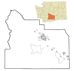
Yethonat is an unincorporated community in Yakima County, Washington, United States. The community developed along the Toppenish, Simcoe and Western Railway Company line.[4] Yethonat is located between Wapato and Toppenish off U.S. Route 97 and is a small, rural agricultural community.
References[edit]
- ^ "Yethonat". Geographic Names Information System. United States Geological Survey, United States Department of the Interior. Retrieved October 25, 2012.
- ^ a b "US Board on Geographic Names". United States Geological Survey. October 25, 2007. Retrieved January 31, 2008.
- ^ "U.S. Census website". United States Census Bureau. Retrieved January 31, 2008.
- ^ "Station Roster Master List: Yethonat". Northern Pacific Railway Historical Association. Retrieved October 25, 2012.
Licensed under CC BY-SA 3.0 | Source: https://en.wikipedia.org/wiki/Yethonat,_Washington31 views | Status: cached on February 02 2024 18:39:25↧ Download as ZWI file
 KSF
KSF

