Centre Island (Antarktika)
 From Wikipedia (De) - Reading time: 1 min
| Centre Island
| ||
|---|---|---|
| Gewässer | Square Bay | |
| Geographische Lage | 67° 52′ 13″ S, 66° 57′ 15″ W | |
|
| ||
| Länge | 6 km | |
| Breite | 3 km | |
| Einwohner | unbewohnt | |
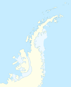
Centre Island (von englisch centre ‚Zentrum, Mittelpunkt‘, in Argentinien Isla del Centro, in Chile Isla Centro) ist eine 6 km lange und 3 km breite Insel im südlichen Abschnitt der Square Bay an der Fallières-Küste des Grahamlands auf der Antarktischen Halbinsel. Sie liegt 2,5 km südlich der Insel Broken Island.
Teilnehmer der British Graham Land Expedition (1934–1936) unter der Leitung des australischen Polarforschers John Rymill entdeckten und benannten sie. Namensgebend ist vermutlich die relative geografische Lage der Insel im Verhältnis zu anderen in der Square Bay befindlichen Inseln.
Weblinks
[Bearbeiten | Quelltext bearbeiten]- Centre Island. In: Geographic Names Information System. United States Geological Survey, United States Department of the Interior, archiviert vom (englisch).
- Centre Island auf geographic.org (englisch)
- Karte der Region. Archiviert vom am 8. Februar 2017.
Licensed under CC BY-SA 3.0 | Source: https://de.wikipedia.org/wiki/Centre_Island_(Antarktika)5 views | ↧ Download this article as ZWI file
 KSF
KSF