Polich Island
 From Wikipedia (De) - Reading time: 1 min
| Polich Island
| ||
|---|---|---|
| Gewässer | Bransfieldstraße | |
| Geographische Lage | 63° 17′ 17″ S, 58° 40′ 29″ W | |
|
| ||
| Länge | 250 m | |
| Breite | 100 m | |
| Einwohner | unbewohnt | |
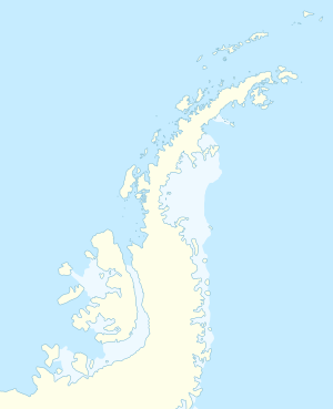
Polich Island (englisch; bulgarisch остров Полич ostrow Politsch) ist eine felsige, in südost-nordwestlicher Ausrichtung 250 m lange und 100 m breite Insel vor der Nordostküste der Astrolabe-Insel nordwestlich der Antarktischen Halbinsel. Sie liegt 90 m nordöstlich des Kanarata Point, 460 m nordnordwestlich von Sagita Island und 2,08 km nordnordöstlich des Drumohar Peak.
Deutsche und britische Wissenschaftler kartierten sie 1996 gemeinsam. Die bulgarische Kommission für Antarktische Geographische Namen benannte sie 2018 nach zwei Gipfeln im bulgarischen Rilagebirge.
Weblinks
[Bearbeiten | Quelltext bearbeiten]- Polich Island im Composite Gazetteer of Antarctica (englisch)
Licensed under CC BY-SA 3.0 | Source: https://de.wikipedia.org/wiki/Polich_Island5 views | Status: cached on November 22 2024 04:56:06↧ Download this article as ZWI file
 KSF
KSF