Mount Cameroon
 From Handwiki
 | Mount Cameroon | |
|---|---|
.jpg) Mount Cameroon from Buea | |
| Highest point | |
| Elevation | 4,040 m (13,250 ft) [1][2] |
| Prominence | 3,901 m (12,799 ft) [3] Ranked 31st |
| Listing | Country high point Ultra |
| Coordinates | [ ⚑ ] : 4°13′00″N 9°10′21″E / 4.2166667°N 9.1725°E |
| Naming | |
| Native name | Mongo ma Ndemi (Duala) (language?) |
| Geography | |
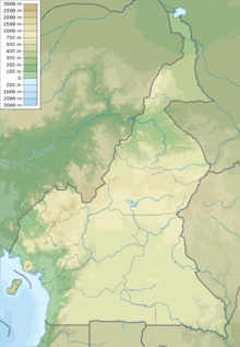 Mount Cameroon Cameroon | |
| Location | Southwest Region, Cameroon |
| Geology | |
| Mountain type | Stratovolcano |
| Last eruption | February 2012 |
| Climbing | |
| First ascent | Joseph Merrick, 1840s[4] |
| Easiest route | Scramble |
Mount Cameroon is an active volcano in the South West region of Cameroon next to the city of Buea near the Gulf of Guinea. Mount Cameroon is also known as Cameroon Mountain or Fako (the name of the higher of its two peaks) or by its indigenous name Mongo ma Ndemi ("Mountain of Greatness").
It is the highest point in sub-Saharan western and central Africa,[5] the fourth-most prominent peak in Africa, and the 31st-most prominent in the world. The mountain is part of the area of volcanic activity known as the Cameroon Volcanic Line, which also includes Lake Nyos, the site of a disaster in 1986. The most recent eruption occurred on February 3, 2012.
Description
Mount Cameroon is one of Africa's largest volcanoes, rising to 4,040 metres (13,255 ft) above the coast of west Cameroon.[6] It rises from the coast through tropical rainforest to a bare summit, which is cold, windy, and occasionally dusted with snow. The massive steep-sided volcano of dominantly basaltic-to-trachybasaltic composition forms a volcanic horst constructed above a basement of Precambrian metamorphic rocks covered with Cretaceous to Quaternary sediments. More than 100 small cinder cones, often fissure-controlled parallel to the long axis of the massive 1,400-cubic-kilometre (336 cu mi) volcano, occur on the flanks and surrounding lowlands. A large satellitic peak, Etinde (also known as Little Mount Cameroon), is located on the southern flank near the coast.
Mount Cameroon has the most frequent eruptions of any West African volcano. The first written account of volcanic activity could be the one from the Carthaginian Hanno the Navigator, who may have observed the mountain in the 5th century BC. Moderate explosive and effusive eruptions have occurred throughout history from both summit and flank vents. A 1922 eruption on the southwestern flank produced a lava flow that reached the Atlantic coast. A lava flow from a 1999 south-flank eruption stopped 200 metres (656 ft) from the sea, cutting the coastal highway.
Flora
The mountain's natural vegetation varies with elevation. The main plant communities on the mountain include:[7]
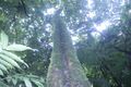
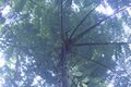
- Lowland rain forest predominates on the lower slopes, from sea level to 800 metres (2,625 ft) elevation. The lowland forests are part of the Cross-Sanaga-Bioko coastal forests ecoregion. They are composed of evergreen trees with a dense canopy 25 to 30 metres (82 to 98 ft) high, with taller emergent trees rising above the canopy. Many trees have buttress roots. The forests are diverse and species-rich, with numerous lianas. Much of the lowland forest has been converted to agriculture and agroforestry, including oil palm plantations.
- Lower montane forest, also known as submontane forest or cloud forest, grows between 800 and 1,600 metres (2,625 and 5,249 ft) elevation. The lower montane forests are composed of evergreen trees, which form a 20–25-metre-high (66–82 ft) canopy that is either closed or discontinuous. There are scattered areas of meadow and scrubland, with grasses, herbs, tall herbaceous plants (including Acanthaceae), tree ferns, woody shrubs, and low trees. Frequent clouds and mists sustain profuse epiphytes, including mosses, ferns, and orchids. The lower montane forests are diverse and species-rich, with characteristic Afromontane plants and endemic species. Impatiens etindensis[8] and I. grandisepala[9] are herbaceous epiphytes endemic to the montane forests of Mount Cameroon. The lower montane forests, together with the higher-elevation forests, scrub, and grasslands, are part of the Mount Cameroon and Bioko montane forests ecoregion.
- Upper montane forest grows from 1,600–1,800 metres (5,249–5,906 ft) elevation. Trees up to 20 metres (66 ft) high form an open-canopied forest with numerous epiphytes. The upper montane forests are less species-rich than the lower-elevation forests, and fires are more frequent.
- Montane scrub grows between 1,800 and 2,400 metres (5,906 and 7,874 ft) elevation. Low trees of 1 to 15 metres (3 to 49 ft) form open-canopied forests, woodlands, and shrublands, with an understory of small shrubs, herbs, ferns, and climbers.
- Montane grassland occurs between 2,000 and 3,000 metres (6,562 and 9,843 ft) elevation. The dominant vegetation is tussock grasses, with scattered fire-tolerant shrubs and low trees.
- Sub-alpine grassland is found at the highest elevations, from 3,000 metres (9,843 ft) to over 4,000 metres (13,123 ft). Frost-tolerant tussock grasses, dwarf trees and shrubs, and crustose, foliose, and fruticose lichens predominate.[7]
Fauna and flora
Large mammals on the mountain include the African forest elephant (Loxodonta cyclotis), with a population of over 100 individuals. Other herbivores include red river hog (Potamochoerus porcus), bushbuck (Tragelaphus scriptus), bay duiker (Cephalophus dorsalis), blue duiker (Philantomba monticola), and yellow-backed duiker (Cephalophus sylvicultor). The mountain is home to several species of primates, including chimpanzee (Pan troglodytes), drill (Mandrillus leucophaeus), red-capped mangabey (Cercocebos torquatus), putty-nosed monkey (Cercopithecus nictitans), mona monkey (Cercopithecus mona), red-eared monkey (Cercopithecus erythrotis), Preuss’ guenon (Cercopithecus preussii), and crowned guenon (Cercopithecus pogonias).[7]
Two species of birds are endemic to Mount Cameroon, Mount Cameroon spurfowl (Pternistis camerunensis) and Mount Cameroon speirops (Zosterops melanocephalus).[7]
Flora
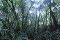
A view of the tropical rain forest on the mountain
Mahogany
Disamara tree
Arum plant
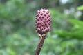
Agaricus mushroom
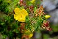
Wild flower
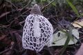
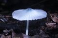
Stinkhorn mushroom
Mount Cameroon National Park
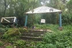
Mount Cameroon National Park (Parc National du Mont Cameroun) was created in 2009. It covers an area of 581.23 km².[10] The park includes the former Etinde Forest Reserve and most of the Bomboko Forest Reserve.[11] A portion of the Bomboko Forest Reserve remains outside the park, on the lower northern slopes of the mountain.[7]
IUGS geological heritage site
In respect of it being 'one of the few volcanoes in the world located at the ocean-continent boundary in a passive tectonic margin', the International Union of Geological Sciences (IUGS) included 'The Quaternary Cameroon Volcano' in its assemblage of 100 'geological heritage sites' around the world in a listing published in October 2022. The organisation defines an IUGS Geological Heritage Site as 'a key place with geological elements and/or processes of international scientific relevance, used as a reference, and/or with a substantial contribution to the development of geological sciences through history.'[12]
Access
The peak is frequently ascended by hikers. The annual Mount Cameroon Race of Hope scales the peak in around 4½ hours. Sarah Etonge has won the race seven times and is also a tour operator. English explorer Mary Kingsley, one of the first Europeans to scale the mountain, recounts her expedition in her 1897 memoir Travels in West Africa.
Gallery
Mount Fako, left view
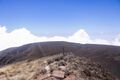
Top view at Mount Fako
.jpg)
Mount Fako
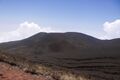
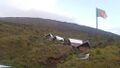
Summit at mount Cameroon
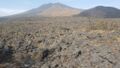
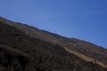
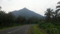
Landscape of Mount Cameroon
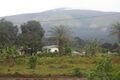
View of the mountain from the base
Accommodation facilities on Mount Fako
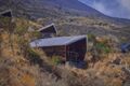
Ditto
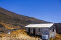
Ditto
Cameroon Mountain Race
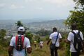
Hikers climbing down
View of Mount Etinde
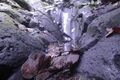
Mount Cameroon tropical rocks
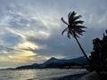
Limbe Beach
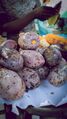
Burning Plum
See also
- Debundscha
- List of volcanoes in Cameroon
Notes
- ↑ A higher elevation of 4,095 m (13,435 ft) is often given, but this is not compatible with SRTM data, which shows no 3" cells higher than 4,027 m (13,212 ft) or 1" cells higher than 4,029 m (13,219 ft).
- ↑ A hand-held GPS reading of 4,045 m (13,271 ft) was reported in 2015.[1] The elevation is subject to change due to volcanic activity.
- ↑ "Mont Cameroun, Cameroon" Peakbagger.com. Retrieved 2012-09-30.
- ↑ DeLancey and DeLancey 174. The authors do not give a precise year, but Merrick was active in Cameroon from 1844 to 1849.
- ↑ "Mount Cameroon", Encyclopedia Britannica
- ↑ Geiger, Harri; Barker, Abigail K.; Troll, Valentin R. (2016-10-07). "Locating the depth of magma supply for volcanic eruptions, insights from Mt. Cameroon" (in en). Scientific Reports 6 (1): 33629. doi:10.1038/srep33629. ISSN 2045-2322. PMID 27713494. Bibcode: 2016NatSR...633629G.
- ↑ 7.0 7.1 7.2 7.3 7.4 The Management Plan of the Mount Cameroon National Park and its Peripheral Zone, 2015 - 2019. The Ministry of Forestry and Wildlife, Republic of Cameroon.
- ↑ Cheek, M. (2014). "Impatiens etindensis". IUCN Red List of Threatened Species 2014: e.T39501A2927828. doi:10.2305/IUCN.UK.2014-3.RLTS.T39501A2927828.en. https://www.iucnredlist.org/species/39501/2927828. Retrieved 18 November 2021.
- ↑ Cheek, M. (2014). "Impatiens grandisepala". IUCN Red List of Threatened Species 2014: e.T39500A2927763. doi:10.2305/IUCN.UK.2014-3.RLTS.T39500A2927763.en. https://www.iucnredlist.org/species/39500/2927763. Retrieved 18 November 2021.
- ↑ "Mont Cameroun". Protected Planet. Accessed 15 June 2020
- ↑ Martin, Alex ed. (2012) Interactive Forest Atlas of Cameroon, Version 3.0. Overview Report. World Resources Institute. ISBN:978-1-56973-789-7. [2]
- ↑ "The First 100 IUGS Geological Heritage Sites". IUGS. https://iugs-geoheritage.org/videos-pdfs/iugs_first_100_book_v2.pdf.
References
- DeLancey, M. W. and M. D. DeLancey. (2000). Historical Dictionary of the Republic of Cameroon (3rd ed.). Lanham, Maryland: The Scarecrow Press.
- "Cameroon". Smithsonian Institution. https://volcano.si.edu/volcano.cfm?vn=224010.
External links
- Mount Cameroon Research Foundation
 |  |
Categories: [Active volcanoes]
↧ Download as ZWI file | Last modified: 06/24/2023 04:33:07 | 2 views
☰ Source: https://handwiki.org/wiki/Earth:Mount_Cameroon | License: CC BY-SA 3.0
 ZWI signed: