Paracuellos De Jarama
 From Handwiki
 Paracuellos del Jarama | |
|---|---|
Municipality | |
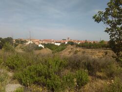 View of Paracuellos from the South | |
 Flag  Seal | |
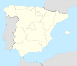 Paracuellos del Jarama Location in Spain | |
| Coordinates: [ ⚑ ] 40°30′17″N 3°31′48″W / 40.50472°N 3.53°W | |
| Country | |
| Autonomous community | Community of Madrid |
| Comarca | Madrid metropolitan area |
| Government | |
| • Mayor | Mesa |
| Area | |
| • Total | 16.96 sq mi (43.92 km2) |
| Elevation | 2,152 ft (656 m) |
| Population (Template:Spain metadata Wikidata)Template:Spain metadata Wikidata | |
| • Total | Template:Spain metadata Wikidata |
| Time zone | UTC+1 (CET) |
| • Summer (DST) | UTC+2 (CEST) |
| Website | Official website |
Paracuellos del Jarama is a small town and municipality in the Community of Madrid, Spain. It is located northeast from Madrid and very close to Madrid-Barajas Airport. The etymology of the name is unclear.[1]
In 1936, it (along with Torrejón de Ardoz) was the site of the Paracuellos massacres.
[ ⚑ ] 40°33′00″N 3°31′00″W / 40.55°N 3.51667°W
Transport
Urban lines
- Line 1: Altos de Jarama urbanization - Miramadrid
- Line 2: Picón del cura - Los Berrocales urbanization
- Line 3: Industrial estate - C.C. San Fernando
Interurban lines
- 210: San Sebastián de los Reyes (Infanta Sofía Hospital) - Paracuellos del Jarama
- 211: Madrid (Canillejas) - Paracuellos del Jarama
- 212: Madrid (Canillejas) - Paracuellos del Jarama (Miramadrid)
- 213: Madrid (Canillejas) - Belvis
- 215: Torrejón de Ardoz - Paracuellos del Jarama
- 256: Madrid (Canillejas) - Daganzo de Arriba - Valdeavero
- 263: Madrid (Barajas) - Cobeña - Algete
References
- ↑ Javier Nájera Martínez, Luis Yuste Ricote: Nombre: Paracuellos, Apellido: de Jarama (Spanish), 3 October 2016, retrieved 10 January 2020.
 |
↧ Download as ZWI file | Last modified: 04/04/2025 21:28:20 | 2 views
☰ Source: https://handwiki.org/wiki/Place:Paracuellos_de_Jarama | License: CC BY-SA 3.0
✘
ZWI is not signed. [what is this?]
ZWI viewer
by the  KSF
KSF