Pyrenees
 From Conservapedia
 The Pyrenees are a European mountain range, running from the Atlantic Ocean to the Mediterranean Sea. They form the natural border between France and Spain, and the small country of Andorra lies entirely within the Pyrenees between the two. The highest mountain in the range is Pico de Aneto (11,168 feet) and a number of other peaks closely approach this height. A few small but shrinking glaciers remain. Much of the Pyrenees is snowbound in winter, some of the higher passes not reopening until early summer.
While the mountains appear craggy and unworn, most geologists believe that they are actually older than the Alps.[1] This is due to the preponderance of hard-wearing granite and comparatively little glaciation.
Important towns in the vicinity of the range include Biarritz, Pau, Tarbes, Lourdes, Foix and Perpignan in France, and San Sebastian, Pamplona, Girona and Figueres in Spain.
Economy[edit]
The Pyrenees remain almost entirely rural, and a considerable exodus of population has taken place in recent years. There have been a number of major construction schemes to make road and rail links across the mountains, but these have brought little permanent employment to the region.
- Tourism is of major importance in the area. Environmentally destructive ski-resort developments have attracted major investment, but with recent warm winters and the threat of global warming, are increasingly risky ventures, and some smaller resorts have already closed down. Others ski resorts have attempted to diversify by attracting more summer tourists.
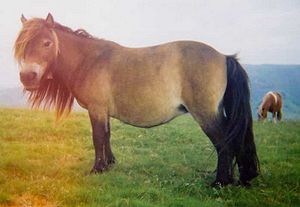
- Traditional farming remains common; cattle and ponies are farmed for meat, and sheep for both meat and milk, which is made into cheese on the spot by the shepherds. The animals are grazed in the high meadows in summer, and herded down into the valleys in winter.
- Wine - There is substantial localised production of wine of excellent quality from vineyards all along the range on both sides.
- Tobacco is a major crop in Andorra.
- Mining has historically taken place in the area for iron, bauxite, tungsten, talc and fluorite, among other things, and continues on a smaller scale today.
- Mineral springs are a resource that are used for both bottled mineral water and health spring resorts.
Wildlife[edit]
The extensive wilderness areas and low population density of the Pyrenees region provides habitat for many species of animal. Of particular interest are;
- The European brown bear, which continues to inhabit the Pyrenees in very low numbers. Additional animals have recently been imported from Slovenia to boost the population although this has caused significant controversy in the livestock farming community.
- The Pyrenean frog is a recently discovered endemic species, breeding only in meltwater lakes at altitudes above 6,000 feet.
- The chamois is distributed throughout the range. The Pyrenean subspecies of ibex became extinct recently, but may become the subject of a cloning programme.
- Small numbers of lynx occur in some parts of the mountains.
- The lammergeier breeds in the central Pyrenees. Griffon and Egyptian vultures are more common. Golden eagles, kites and many other birds of prey also breed here.
- The ptarmigan inhabits the mountain tops.
- Salamanders inhabit springs in the high mountains.
- There are a number of endemic plant species, notably the Pyrenean yam and the insectivorous long-leaved butterwort.
Leisure activities[edit]
- Walking. Three long-distance footpaths run from end to end of the range; the GR10 in France, the GR11 in Spain, and the HRP, running along the shortest (and most mountainous) route from coast to coast. Many other shorter paths also exist.
- Mountaineering is popular, noted localities including Aiguestortes, Maladeta and the Ordesa area.
- Caving - The Pyrenees contains a number of deep and historic cave systems, notably the Gouffre de la Pierre St Martin and the Gouffre Martel.
- Skiing. There are a number of sizeable ski resorts in all three Pyrenean countries.
- Various other outdoor pursuits such as paragliding, canyoning, white-water rafting, etc. can be found throughout the range.
- Cycling - The Tour de France and Vuelta a España (Tour of Spain) races both hold a number of stages in the mountains, attracting large numbers of spectators, and recreational cycling is also popular.
References[edit]
Categories: [European Mountains] [France] [Spain]
↧ Download as ZWI file | Last modified: 02/14/2023 03:21:23 | 9 views
☰ Source: https://www.conservapedia.com/Pyrenees | License: CC BY-SA 3.0
 ZWI signed:
 KSF
KSF