Strait Of Magellan
 From Nwe
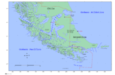
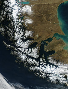
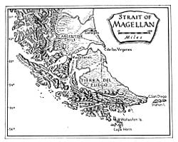
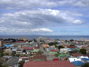
 The Strait of Magellan (often referred to as the Straits of Magellan or the Magellan Strait) is a channel at the southern tip of South America linking the Atlantic Ocean and Pacific Ocean. This navigable sea route separates the mainland from Tierra del Fuego and other islands south of the continent. Except for a few miles at its easternmost extremity in Argentina, it lies within Chilean territorial waters. The strait’s major port is Punta Arenas on the Brunswick Peninsula.
The first European to navigate the strait was Ferdinand Magellan, a Portuguese maritime explorer sailing for Spain, who discovered the strait in 1520 during the first successful attempt at circumnavigating Earth.
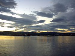
The strait is approximately 600 kilometers (370 mi) long, and ranges from 3 to 35 kilometers (1.9 to 22 mi) at its narrowest and widest points, respectively. An important natural passage between the oceans, it is considered a difficult route to navigate because of the inhospitable climate and the narrowness of the passage. The strait was an important sailing-ship route before 1914 and the completion of the Panama Canal, which shortened the Atlantic Pacific passage by several thousand miles. Though it follows a difficult and often foggy path among numerous islands and channels, it allows an inland passage protected from almost continuous ocean storms. It continues to be used by ships rounding South America from the Atlantic Ocean or the Pacific Ocean.
Sovereignty disputes between Argentina and Chile involving the waters and islands of the Strait nearly led to war in 1978, averted only by the intercession of Pope John Paul II. The subsequent Treaty of Peace and Friendship of 1984 between Chile and Argentina resolved a number of important boundary issues and promoted economic relations and integration between the two nations.
Geography
Course
The Strait of Magellan is approximately 600 kilometers (370 mi) long, and ranges from 3 to 35 kilometers (1.9 to 22 mi) at its narrowest and widest points, respectively. The northwestern portion of the strait is connected with other sheltered waterways via the Smyth Channel. This area is similar to those of the Inside Passage of Alaska. Southward from Cape Froward, the principal shipping route follows through the Magdalena Channel. It links the strait with the Beagle Channel.
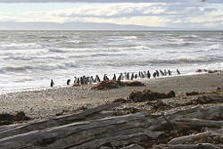
The eastern opening is the wide bay on the border of Chile and Argentina between Punta Dúngeness on the mainland and Cabo del Espiritu Santo on Tierra del Fuego, the border defined in the Treaty of Peace and Friendship of 1984 between Chile and Argentina. Immediately west are the narrows Primera Angostura and Segunda Angostura, which are formed by two different-aged terminal moraines. Here also lies Magdalena Island, which is part of Los Pingüinos Natural Monument, home of the largest penguin colonies of south Chile, including an estimated 60,000 breeding pairs of the Magellanic Penguin.[1] In this part of the strait, its southern boundary follows first the shoreline of the Isla Grande de Tierra del Fuego, then follows the northern end of the Canal Whiteside and continues along the shoreline of Dawson Island.
The western part of the strait stretches northwestward from the northern end of Magdalena Channel to the strait's Pacific entrance. This portion of the strait is flanked on the south by Capitán Aracena Island, Clarence Island, Santa Inés Island, Desolación Island and other smaller islands, and on the north by Brunswick Peninsula, Riesco Island, Muñoz Gamero Peninsula and other minor islands. Here, two narrow channels that open into the strait connect with Seno Otway and Seno Skyring. The Francisco Coloane Coastal and Marine Protected Area, which protects Humpback Whales, is located in this area. This part of the strait lies on the elongated Magallanes-Fagnano Fault, which marks a plate boundary between the South American Plate and the Scotia Plate. This fault continues southward under the Almirantazgo Fjord and then low the Fagnano Lake.
Features
The Smyth Channel is a principal Patagonian channel. Its north entrance is in the Nelson Strait. Its south arm is the southward continuation of the Sarmiento Channel. The southern terminus is at the point of alignment of the Phillip Cape in the southern extreme of Manuel Rodríguez Island with the mainland peninsula Merino, at which point it opens into the Strait of Magellan.
The channel has a length of approximately 96 nautical miles (178 km/110 mi) and is divided into two arms. The 50 nautical miles (93 km/58 mi) long northwest arm, which is rarely used as navigation route. The south arm, at 46 nautical miles (85 km/53 mi) long, is a major waterway for commercial sailing that stretches from its connection with the Sarmiento Channel at southern tip of the Victoria Pass until the point where it joins the Strait of Magellan.
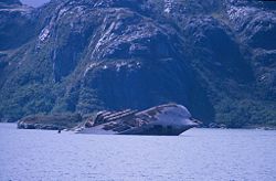
The channel is flanked by mountain ranges of exposed granite that at their foothills have limited vegetation cover due to continuous strong winds. In the northwest arm the hills are high, including the 890 meters (2,900 ft) Monte Nuestra Señora de la Victoria and the 890 meters (2,900 ft) Lecky Look Out on Contreras Island, and the 510 meters (1,700 ft) Monte Lucía on Diego de Almagro Island.
In the vicinity of its south arm is the 1,495 meters (4,900 ft) Monte Burney, which lies on the mainland's Muñoz Gamero Peninsula. This imposing volcanic peak stands out from the mountains that surround it. Other mountains in the area include Monte Joy at 443 meters (1,450 ft) and the peaks Sainte Agnes and Sainte Anne with elevations of 323 meters (1,060 ft) and 513 meters (1,680 ft) high respectively, which stand on the Manuel Rodríguez Island.
The Magdalena Channel joins the Strait of Magellan with Cockburn Channel and is part of a major navigation route which ultimately connects with the Beagle Channel. It separates Capitán Aracena Island from the westernmost portion of Isla Grande de Tierra del Fuego, and crosses Alberto de Agostini National Park. It is flanked by mountains, the chief of which is the 2,246 meters (7,370 ft) Monte Sarmiento. Together with the Abra Channel and the Bárbara Channel, it join the westside of the Strait of Magellan directly with the Pacific Ocean.
Punta Dúngeness is a headland at the eastern entrance of the Strait of Magellan on its north shore, opposite Cabo del Espiritu Santo in Tierra del Fuego. West of the Punta Dungeness lies the Bahia Posession. Punta Dungeness marks the border between Chile and Argentina, and according to the Treaty of Peace and Friendship of 1984 between Chile and Argentina the line between Punta Dungeness and Cabo del Espiritu Santo marks the limits of each country's territorial waters. It is the southernmost point on the mainland of Argentina, and the easternmost point on the mainland of Chile. There is a lighthouse on the Chilean side.
Dawson Island is located southeast of Brunswick Peninsula and is an approximately 2,000 square kilometers (770 sq mi) tract of land that is often lashed with harsh Antarctic weather. In the late 1800s the island was used as a concentration camp for the Selknam and other native people. Following the 1973 military coup, it was used as a place to house political prisoners. About 30 important political figures involved in Salvador Allende's overthrown Popular Unity government were sent to Dawson Island following the coup, alongside some 200 prisoners from the local area. Infamous for its forced labor practices and conditions of squalor, it was shut down in 1974.[2]
Riesco Island lies west of the Brunswick Peninsula. It has an area of 5,110 square kilometers (1,970 sq mi). Its highest point is Mount Atalaya at 1,830 meters (6,000 ft). The island is bordered by two large piedmont embayments: Otway Sound and Skyring Sound. A narrow channel connects both bodies of water and separates the island from the Patagonia mainland. The island is separated from the southern part of the Muñoz Gamero Peninsula by another narrow channel. Glaciers occur on Riesco. In the north, an icefield is the source of seven glaciers, while there are 12 glaciers on the slopes of Cerro Ladrillero. In the southern portion of the island, Córdova Peninsula marks the eastern limit of the Strait of Magellan and is home to several mountain glaciers.
Riesco Island hosts Chile's largest known coal reserves. It is believed to contain more than 300 million tonnes of low-quality coal in three deposits: Río Eduardo, Elena and Estancia Invierno.
Seno Otway is a large inland sound lying between Brunswick Peninsula and Riesco Island. Alternatively called Otway Sound, this natural waterway occupies a valley blocked by a large terminal moraine left by the retreat of a glacier during the last glacial period. In spite of being located east of the Andes, it is connected to the open Pacific Ocean through the Strait of Magellan via a narrow passage which cuts into the Andean Massif. Seno Otway also is hydrologically connected with Seno Skyring by the FitzRoy Channel.
There are a variety of marine species within the Otway Sound, as well as along the coastal terrestrial and intertidal zones. Notably there is a moderately large colony of the Magellanic Penguin along the coast.[1]
History
Ferdinand Magellan, a Portuguese sailor in service to the Spanish King, became the first European to navigate the strait in 1520, during his global circumnavigation voyage. Because Magellan's ships entered it on November 1, All Saints' Day, it was originally named Estrecho de Todos los Santos (Strait of All Saints). Later the Spanish king changed the name to Estrecho de Magallanes in honor of Magellan. From the time of its discovery both the Spanish Empire and the Kingdom of Chile saw it as Chile's southern boundary.
In 1577, Sir Francis Drake was commissioned by Queen Elizabeth to undertake an expedition against the Spanish along the Pacific coast of the Americas. He set sail from England on December 13, aboard the Pelican, with four other ships and 164 men. After crossing the Atlantic, one of the ships turned back through the east coast of the Magellan Strait. Drake crossed from the Atlantic to the Pacific through the Strait. After this passage a storm blew his ship so far south that he realized Tierra del Fuego was not part of a southern continent, as was believed at that time.
Pedro Sarmiento de Gamboa explored the southern Pacific coast of South America in 1578-1579, including the Strait of Magellan. He returned to Spain in 1580 with impressive maps and reported the results of his expedition to King Philip II of Spain. Philip resolved to fortify the Strait, and in 1581 sent an expedition of 24 vessels with 2,500 men from Cadiz, under the command of Sarmiento de Gamboa and Diego Flores Valdez. After loss and abandonment, only four vessels arrived in January 1583. Sarmiento de Gamboa established a fort and colony garrisoned by 300 men which he called Rey Don Felipe on the strait's northern shores. The settlement suffered severe food shortages, and when Thomas Cavendish visited the ruins in 1587 he renamed the place Port Famine.
Phillip Parker King left Plymouth in May 1826 in command of the British survey vessel HMS Adventure, accompanied by the HMS Beagle which was commanded by Pringle Stokes. They established a base at Port Famine from which they spent four seasons surveying. The winters were spent in more hospitable climates on the continent. King thoroughly explored and charted the Strait, and presented the results at a meeting of the Royal Geographical Society in 1831.
Chile took possession of the channel on May 23, 1843. Chilean president Bulnes ordered the expedition after speaking with the Chilean libertador Bernardo O'Higgins who feared an occupation by Great Britain or France. The first Chilean settlement was Fuerte Bulnes situated in a forested zone on the north side of the Strait. Fuerte Bulnes was later abandoned and the city of Punta Arenas was founded in 1848 further north where the Magellanic forests met the Patagonian plains. In front of Punta Arenas, on the other shore of the Strait in Tierra del Fuego the village of Porvenir emerged during a gold rush in the late 1800s.
Until the Panama Canal was finished in 1914, the Strait of Magellan was the main route for steam ships traveling from the Atlantic Ocean to the Pacific; it was often considered the only safe way to move between the Atlantic and Pacific Oceans. Protected by Tierra del Fuego to the south and the bulk of South America to the north, ships crossed with relative ease, removed from the dangers of Drake Passage. Despite these natural defenses, sailing ships such as the clippers preferred Drake Passage as they had more room to maneuver. The Drake Passage is the relatively narrow stretch of ocean separating Cape Horn from Antarctica, the waters of which are notoriously turbulent, unpredictable, and frequented by icebergs and sea ice.
Concerns
International relations
Argentina and Chile share the world's third-longest international border, which is 5,300 kilometers (3,300 mi) long and runs from north to the south along the Andes mountains. During much of the nineteenth and the twentieth century, relations between the countries chilled due mainly to disputes over Patagonia.
Conflict over the Beagle islands began in 1904 when Argentina defined as "disputed territory" islands that had been under Chilean control since an 1881 treaty. Trouble mounted in the 1960s, when Argentina began to lay claim to the Picton, Lennox and Nueva islands in the Beagle Channel. Both countries submitted their maritime boundary dispute to arbitration by an international tribunal in 1971. In 1977 the British Monarch awarded three disputed islands in the Beagle Channel to Chile. Argentina rejected the decision.[3]
Attempts at direct negotiations between the two countries failed, and in December 1978 they prepared for war. This was averted when Pope John Paul II sent a personal message to both presidents urging a peaceful solution. They agreed to mediate the dispute through the offices of Cardinal Antonio Samoré, the special Papal envoy. The conflict was resolved through papal mediation and since 1984 Argentina recognizes the islands as Chilean territory.
The 1984 treaty also resolved other collateral issues of great importance, including navigation rights, sovereignty over other islands in the Fuegian Archipelago, delimitation of the Straits of Magellan, and maritime boundaries south to Cape Horn and beyond.
Resolutions
In recent years relations have improved dramatically, based upon the foundation laid by the Treaty of Peace and Friendship of 1984 between Chile and Argentina. According to the dispute solution, the parties involved "reiterate their commitment to preserve, strengthen and develop their unchanging ties of perpetual friendship and to refrain from resorting directly or indirectly to any form of threat or use of force and from adopting any other measures which may disturb the peace in any sector of their mutual relations." They agree to "create a Conciliation Commission if necessary and, if it fails, create an Arbitration Tribunal. The decision of the tribunal shall be binding on the Parties, final and unappealable. Its implementation shall be entrusted to the honor of the nations signing the Treaty of Peace and Friendship."[4]
The 1984 treaty reaffirmed the need to promote economic relations as the building blocks for a lasting peace. Subsequent disputes over natural gas pipelines eventually led to political leaders in both nations to view economic integration as not only a means of promoting growth but also a way of consolidating democracy.[3]
Notes
- ↑ 1.0 1.1 C. Michael Hogan, November 27, 2008, Magellanic Penguin Global Twitcher. Retrieved February 14, 2009.
- ↑ Derechos Chile. Human rights in Chile: Dawson Island Retrieved February 14, 2009.
- ↑ 3.0 3.1 David R. Mares. May 2004. Natural Gas Pipelines in The Southern Cone Program on Energy and Sustainable Development at Stanford University. Retrieved February 15, 2009.
- ↑ United Nations, February 18, 1977, Reports of International Arbitral Awards Retrieved February 14, 2009.
References
ISBN links support NWE through referral fees
- C. Michael Hogan. November 27, 2008. Magellanic Penguin Global Twitcher. Retrieved February 14, 2009.
- Derechos Chile. Human rights in Chile: Dawson Island Retrieved February 14, 2009.
- ISMAR Bologna. The Straits of Magellan and Oceanographical Setting Retrieved February 13, 2009.
- Kent, Rockwell. 2000. Voyaging southward form the Strait of Magellan. Hanover, NH [u.a.]: Univ. Press of New England. ISBN 9780819564092
- Markham, Clements R. 1911. Early Spanish voyages to the strait of Magellan. Works issued by the Hakluyt Society, 2nd ser., no. 28. London: Printed for the Hakluyt Society. OCLC 9060328
- Morris, Michael A. 1989. The Strait of Magellan. International straits of the world, v. 11. Dordrecht: M. Nijhoff. ISBN 9780792301813
- U.S. Geological Survey. Past Glaciations and "Little Ice Ages" Retrieved February 13, 2009.
Credits
New World Encyclopedia writers and editors rewrote and completed the Wikipedia article in accordance with New World Encyclopedia standards. This article abides by terms of the Creative Commons CC-by-sa 3.0 License (CC-by-sa), which may be used and disseminated with proper attribution. Credit is due under the terms of this license that can reference both the New World Encyclopedia contributors and the selfless volunteer contributors of the Wikimedia Foundation. To cite this article click here for a list of acceptable citing formats.The history of earlier contributions by wikipedians is accessible to researchers here:
- Strait_of_Magellan history
- Smyth_Channel history
- Magdalena_Channel history
- Punta_Dúngeness history
- Dawson_Island history
- Riesco_Island history
- Seno_Otway history
- Beagle_conflict history
The history of this article since it was imported to New World Encyclopedia:
Note: Some restrictions may apply to use of individual images which are separately licensed.
↧ Download as ZWI file | Last modified: 02/04/2023 06:04:22 | 62 views
☰ Source: https://www.newworldencyclopedia.org/entry/Straits_of_Magellan | License: CC BY-SA 3.0
 ZWI signed:

 KSF
KSF