Navigation
 From Conservapedia
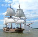
 Navigation is the theory and practice of navigating: plotting, ascertaining, and charting the course of a ship or aircraft. From the Latin root "navigationem" meaning "to sail, sail over, go by sea, steer a ship."
Ocean-going navigation was difficult before the invention of the compass, with nearly all navigation taking place within sight of shore. Mariners could use the North Star on a clear night to get a rough sense of direction.
The invention of the sextant made it possible to determine latitude (i.e., distance from the Earth's north pole in degrees), but determination of longitude awaited the invention of an accurate sea-going chronometer.
Modern inventions such as LORAN and the GPS make it possible to determine a ship's precise position to within 50 feet.
[edit]
Prior to the commercial use of the GPS (Global Positioning System), the most common navigational system in use for international passenger flights was the Inertial Navigation System (INS). Whereas the LORAN (Long Range Navigation) system used navigational aids external to the aircraft ("master" land station and two or more "slave" stations transmitting low or medium intersecting signals), INS was entirely internally based using gyroscopes and accelerometers (which detect changes in an aircraft's motion in any direction in reference to the gyroscopic lines) which minutely and continuously (seven times a second) adjusted through the automatic pilot the aircraft in flight - taking into account the changing wind, velocity, weight and other conditions. An aircraft using INS was guided by preflight insertion of up to nine navigational "waypoints". If more were need, number 10 and subsequent were inserted during the flight replacing entries overflown and "vacated". Three independent but electrically linked INS units were generally installed in a passenger plane - two active and "'redundant" with displays for pilot and co-pilot and one "hot spare".
A famous incident involving a passenger plane that strayed from its INS guided flight path was the shootdown by the Soviets of Korean Airlines Flight 007 - shot down west of Sakhalin Island in 1983. Either the pilots had failed to switch from Magnetic Heading to INS, or did so but out of the maximum range of 7 1/2 Nautical Miles from the "desired track". This mistake may have lead to the shootdown itself.[1] It was due to KAL 007's deviation from its route while using INS that President Reagan authorized GPS to be used for non-military navigational purposes.
See also[edit]
References[edit]
Categories: [Navigation]
↧ Download as ZWI file | Last modified: 02/14/2023 03:21:23 | 163 views
☰ Source: https://www.conservapedia.com/Navigation | License: CC BY-SA 3.0
 ZWI signed:
 KSF
KSF