Tasmanian Wilderness
 From Nwe
| Tasmanian Wilderness* | |
|---|---|
| UNESCO World Heritage Site | |
|
|
|
| State Party | |
| Type | Mixed |
| Criteria | iii, iv, vi, vii, viii, ix, x |
| Reference | 181 |
| Region** | Asia-Pacific |
| Inscription history | |
| Inscription | 1982 (6th Session) |
| Extensions | 1989 |
| * Name as inscribed on World Heritage List. ** Region as classified by UNESCO. |
|
The Tasmanian Wilderness World Heritage Area is a contiguous network of reserved land that extends over much of southwestern, western, and central Tasmania, Australia. In addition to being a vast expanse of protected temperate rainforest, the region contains alpine, sclerophyll, buttongrass moorland, and grassland as well as grassy woodland communities. Human remains found in limestone caves throughout the area attest to occupation for tens of thousands of years.
The area incorporates numerous individually designated national parks, forest reserves, state reserves, and conservation areas extending across 1.38 million hectares (3.41 million acres). Diverse natural environments, coupled with cultural and historical significance have earned the region importance as a UNESCO World Heritage Site of outstanding natural and cultural value.
The wilderness region's pristine natural environment has cultural associations with both indigenous peoples and the Western colonization period. Archaeological and historical sites found in the Tasmanian wilderness include Maxwell River and Wargata Mina and the ruins of Tasmania’s first penal colony at Macquarie Harbour.
Description
The Tasmanian Wilderness World Heritage Area on the Australian island of Tasmania is one of the country's largest protected areas. It is comprised of multiple variously designated protected areas such as national parks, conservation areas, state and forest reserves, and historical preservation areas, totaling approximately 1.38 million hectares (3.41 million acres), or about 20 percent of Tasmania's total land area. It was designated a World Heritage Site in 1982, with UNESCO extending its area, in 1989, to its present boundaries. Within the area are natural, cultural and historical features of global significance.
The area contains alpine vegetation, extensive tracts of tall eucalypt forest, and one of the last expanses of temperate rainforest in the world. These provide habitats for a range of plants and animals that are not found anywhere else in the world, including many rare and endangered species. In addition, a high proportion of Tasmania's karst areas, glacial landscapes, and known archaeological sites also occurs within the area.
A rich and complex geology has created landforms of immense beauty. There is evidence within its limestone caves of human habitation for tens of thousands of years. In addition, Tasmania’s first penal colony in Macquarie Harbour, which operated from 1822 to 1833, is contained within the protected area.
Geology

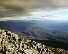
Australia's greatest variety of landscapes and geological types are found in this area, including rocks from all but one geological period. The area holds some of the deepest and longest caves in the country, and is renowned for its dramatic scenery which includes roaring rivers, deep valleys, dramatic mountain peaks and impressive gorges.
The oldest rocks—quartzites and quartz schists—date to the Precambrian period over one billion years ago, and form some of the area's mountains. The Cambrian and Ordovician periods donated sandstones, siltstones, and conglomerates, which are rich with ancient marine fossils.
Sedimentary rocks and fossil assemblages from the Permian and Triassic periods are similar to those on other continents, seeming to support the theory of the existence of the supercontinent, Gondwana. Tectonic activity during the Jurassic laid the foundations of the dolerite mountains scattered throughout the area. Widespread faulting during the Tertiary contributed to much of today's landscape. Three major glaciations during the Pleistocene carved rugged mountain landscapes and formed lakes, cirques and U-shaped valleys common to the Wilderness area.
Extensive areas of developed limestone, in some places as much as two kilometers (1.25 miles) thick, are found throughout the area. The acidic weathering of this stone has led to the formation of Australia's largest and deepest cave systems. Among these are are globally significant Aboriginal sites which have revealed some of the nation's richest archaeological finds. Others reveal formations of great beauty such as those found in Marakoopa Cave.
Flora and fauna
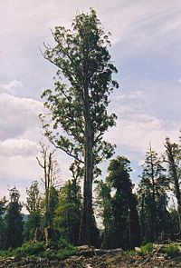
The Wilderness protected area includes a wide range of plant communities within such environments as: cool temperate rainforest; alpine communities; extensive buttongrass moorlands; sclerophyllous forests; and riverine rainforest. Two-thirds of Tasmania's endemic higher plant species are contained within Wilderness boundaries; the distribution of many of them confined to this Area. Nearly one-third of the plant species in Tasmania that are listed as rare or threatened occur within the Wilderness area.
Some of the Area's temperate rainforests—characterized by an open, verdant, cathedral-like quality—contain descendants of some of Australia's most ancient plants, some dating more than 60 million years, such as native plum and leatherwood.
The site's alpine communities are dominated by shrubs, different from the mainland. Cushion plants, scoparia, and deciduous beech are included in the sixty percent of alpine flora which is endemic to Tasmania.
The second longest lived organism in the world after the Californian bristlecone pine, the Huon pine, can live 3,000 years. These occur in the riverine rainforest habitats in the Area's western section.
Buttongrass moorlands are extensive throughout the region, with over 150 vascular plant species showing in this nutrient-poor soil. One third of these plants are endemic to Tasmania.
Old-growth sclerophyllous forests contain the greatest diversity of living plants and animals in Tasmania. These forests are dominated by swamp gum, a type of Eucalyptus that can grow taller than 100 meters (328 feet).
The extensive range and variety of environments provided within the Area provide for secure habitats for some of the most unique animals in the world. Many species which recently became extinct on the Australian mainland and are threatened on Tasmania are protected within the World Heritage area.
A number of species that live within the Area are ancient relics. Some species, such as velvet worms, (Euperipatoides and Ooperipatellus spp.) have changed little in the last half billion years. Some consider these to be the missing link between worms (annelids) and crustaceans and insects (arthropods). The 250 million year old mountain shrimp (Anaspides tasmaniae) is an ancient representative of crustaceans present in the area. Marsupials, parrots, frogs, and freshwater fish are also abundant.
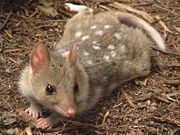
The isolation of Tasmania has given rise to the evolution of a number of endemic species. More than half the mammals on the island are recognized as distinct subspecies from their mainland counterparts, while five mammal species are fully endemic. The world's three largest carnivorous marsupials live within the World Heritage Area: the Tasmanian Devil, the spotted-tail quoll, and the eastern quoll.
While the Tasmanian Wilderness World Heritage Area provides habitat for species which have become extinct on the Australian mainland, it also provides safe haven for threatened species on Tasmania. Nineteen rare and threatened vertebrates are found within its boundaries, representing eighty percent of such species in the state. Endangered birds, lizards, freshwater fish, and such invertebrates as the pencil pine moth, freshwater snails, caddisflies, stoneflies, and dragonflies also find safe habitat within the Area.
Cultural and historic heritage

Tasmania was cut off from mainland Australia by the flooding of Bass Strait at least 8,000 years ago, isolating the aboriginal inhabitants. The Tasmanian Aborigines were one of the longest isolated human groups in history, surviving some 500 generations without outside influence.
Archaeological evidence indicates a significant Pleistocene hunter-gatherer society inland in the southwestern region dating to at least 30,000 years ago. The climate at that time was significantly colder and drier than at present. The sites reveal the distinctive means the Aborigines developed by which to survive climate change and Ice Age conditions.
More than forty sites have been discovered in the southwest inland river valleys which provide a rich collection of Aboriginal history, including painted cave and rock art sites, including Kutikina Cave on the Franklin River. These sites are of great importance to the Tasmanian Aboriginal community for their exceptional cultural, emotional and spiritual value.
Included in the World Heritage Site is the Macquarie Harbour Historic Site, a nineteenth century penal colony on the west coast of Tasmania. Originally built for British convicts, many Irish patriots and Tasmanian Aborigines were also detained there. It had the notorious reputation as a prison which practiced "extreme physical and mental torture." The site is considered to be an outstanding example of one of the most significant features of world population movement in the eighteenth and nineteenth centuries—the transportation of convicts.
Additional historic sites include trappers' huts, mines, tracks, tramways and long-abandoned settlements such as Adamsfield and Pillinger. Preservation of the sites serves as testimony to the activities and lifestyles of these early settlers and guards their legacy of human interaction with the wilderness.
Protected areas
The Tasmanian Wilderness World Heritage Area, with its diverse habitats including jagged coasts, islands, major estuaries, alpine plateau and mountain peaks, turbulent rivers, sheltered lakes, rain forest and moorland, along with cultural and historical sites, covers one-fifth of Tasmania's land area. The following protected areas, totaling 1,383,640 hectares (3,419,049 acres), are included in the UNESCO site:
- Cradle Mountain-Lake St Clair National Park—161,000 ha
- Franklin-Gordon Wild Rivers National Park—440,120 ha
- Southwest National Park—605,000 ha
- Walls of Jerusalem National Park—51,800 ha
- Hartz Mountains National Park—7,140 ha
- Mole Creek Karst National Park—1,345 ha
- Reserves
- Devils Gullet State Reserve—806 ha
- Marakoopa Cave State Reserve—790 ha
- Liffey Falls State Reserve (partially contained) 20 ha
- Farm Cove Game Reserve—1,720 ha
- Meander Forest Reserve—1,660 ha
- Liffey Forest Reserve—1,055 ha
- Drys Bluff Forest Reserve—680 ha
- Conservation areas
- Central Plateau Conservation Area—89,200 ha
- Southwest Conservation Area—616 ha
- Adamsfield Conservation Area—5,400 ha
- Marble Hill Conservation Area—77 ha
- Historic sites
- Macquarie Harbour Historic Site—15,300 ha
- Wargata Mina Protected Archaeological Site—155 ha
- Maxwell River Protected Archaeological Site—560 ha
- Other designated areas
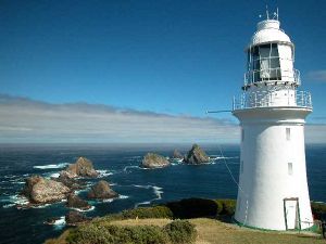
- Maatsuyker Island (Commonwealth freehold)—180 ha
- St. Clare Lagoon—29 ha
- Privately-owned land—320 ha
Five of the national parks in the protected area form a continuous chain covering nearly a quarter of Tasmania’s land mass, and comprise the majority of the land contained within the world heritage area.
Cradle Mountain-Lake St. Clair National Park
Cradle Mountain-Lake St. Clair is a national park in Tasmania's Central Highlands area, 165 km (102 mi) northwest of the capital city, Hobart. Major features of the park are Lake St. Clair and to the north, Cradle Mountain.
The Cradle Mountain-Lake St. Clair National Park is a significant location of Tasmania's endemic species - 40-55 percent of the park's documented alpine flora is endemic. Furthermore, 68 percent of the higher rainforest species recorded in alpine areas in Tasmania are present in the Cradle Mountain-Lake St. Clair National Park. The park's alpine vegetation is very diverse and has largely escaped forest fires that have caused neighboring regions to suffer.
Animals common in the park include: pademelons, Bennett's wallabies, wombats, possums, ravens and currawongs.
The park contains many walking trails, the most well known of which is the Overland Track. The Tasmanian Government has moved to allow development in national parks and conservation areas. An "in principle" permit has been granted for the establishment of an "eco-friendly" resort at Pumphouse Point at Lake St. Clair.
Franklin-Gordon Wild Rivers National Park
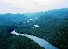
Franklin-Gordon Wild Rivers is a national park contained within the protected area, 117 km (73 mi) west of Hobart. It is named after the two main river systems lying within the bounds of the park—the Franklin River and the Gordon River.
The Franklin-Gordon Wild Rivers National Park lies between the Central Highlands and West Coast Range in the heart of the Tasmanian Wilderness World Heritage Area. It is dissected by the only road to pass through the area—the Lyell Highway.
The genesis of the Wild Rivers National Park was in the earlier Frenchmans Cap National Park which had the Franklin River as its boundary on the northern and western borders. Frenchmans Cap, prominent mountain and dominant feature in the region, can be seen on the skyline from the west and north of the park. The peak served as an early landmark for ships sailing the west coast, and was used as a guiding beacon by many, largely unsuccessful, parties of escaping convicts from the Macquarie Harbour Penal Station as they attempted to struggle through the dense scrub of Western Tasmania to the settled districts further east.
The Gordon and Franklin Rivers were the subject of one of Australia's largest conservation battles—the battle to save the Gordon River from being dammed for a proposed hydroelectric power scheme that had been in the plans of Hydro Tasmania for some time. It became a national issue for the Tasmanian Wilderness Society from 1978 to 1983.
The Lyell Highway winds for 56 km (35 mi) through the heart of the Franklin-Gordon Wild Rivers National Park.
Southwest National Park
The eastern boundary of Southwest National Park is 93 km (58 mi) west of Hobart. From there the park stretches to the west and south coasts. It is the largest national park within the protected area and covers much of Tasmania's southwestern wilderness. The core of the park was created in 1955, and was originally called Lake Pedder National Park. Over the following 35 years the park was gradually extended and renamed, finally reaching its present size in 1990.
The park is well known for its pristine wilderness and remoteness, and is largely unaffected by humans. The southern and western reaches of the park are far removed from any vehicular access, and can only be reached by foot, boat, or light aircraft.
The park is popular with trekkers. Two main walking tracks cross the park, one south from Lake Pedder to the town of Melaleuca, the other west from Cockle Creek along Tasmania's south coast to Melaleuca. The walks are generally for more experienced walkers, taking approximately ten to fourteen days to complete the full route. Several more difficult walks exist, encompassing the Eastern and Western Arthurs Ranges, Precipitous Bluff, the South West Cape, and Federation Peak, the latter considered by many to be Australia's most difficult and dangerous walk.
Although evidence shows Tasmanian Aborigines have visited the area for at least 25,000 years, and European settlers have made occasional forays into the park area since the 19th century, there has been very little permanent habitation and only minimal impact on the natural environment.
Hartz Mountains National Park
Hartz Mountains National Park was originally designated a scenic reserve in 1939. Located 55 km (34 mi) southwest of Hobart, the park is a popular destination for weekend excursions. Usually covered with snow in winter, it attracts a large numbers of cross-country skiers. It is well known for its beautiful waterfalls which come to life when the snow melts in late spring.
The park also includes a chain of high dolerite peaks which run north to south through the park between the Arve and Picton river systems. The highest point is Hartz Peak at 1,255 meters (4,117.5 feet). There are beech rain forest, expanses of eucalyptus forest, Alpine moorland with heath vegetation and snow gums. The elevation provides grand views of the wild highlands of Tasmania, extending eastward to Bruny Island.
Mole Creek Karst National Park
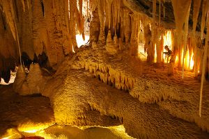
Mole Creek Karst National Park, which features richly decorated limestone caves, is located in north-central Tasmania, 168 km (104 mi) from Hobart. It is the only national park in Tasmania created specifically to protect Karst topography karst landforms.
The park's 1,345 hectares (3,324 acres) contains a total of 300 caves and sinkholes, the best known being the Marakoopa and King Solomons Caves. The park is rich in deep limestone caves of superb stalactites, stalagmites and columns, glow worm displays, subterranean streams and cathedral caverns.
Walls of Jerusalem National Park
Walls Of Jerusalem National Park is located 144 km (90 mi) northwest of Hobart. The park takes its name from the geological features of the park which are thought to resemble the walls of the city of Jerusalem in Israel. As a result many places and features within the park also have Biblical references for names, such as Herods Gate, Lake Salome, Solomons Jewels, Damascus Gate, the Pool of Bathesda.
The most prominent feature of the park is King Davids Peak, the tenth highest mountain in Tasmania at 1,499 meters (4,918 ft). A popular and impressive feature of the park is the huge chamber created by the West Wall, Mount Ophel, Zion Hill and the Temple. Near this is a pencil pine forest known as Dixon's Kingdom. It overlooks the Central Plateau region with its numerous lakes abundant vegetation.
Central Plateau Conservation Area
The Central Plateau Conservation Area is an animal & plant conservation area in the central highlands region. It extends west and south from the escarpment of the Great Western Tiers and abuts the Walls of Jerusalem National Park.
It is also known as the "Land of Three Thousand Lakes" for the glittering lakes and tarns that dot the landscape, making it a favorite of fisherman. The largest of the lakes are the Great Lake, Lake Echo, Lake Sorell, Arthurs Lake and Lake St Clair.
References
ISBN links support NWE through referral fees
- Australian Government. Tasmanian Wilderness. Retrieved September 4, 2008.
- Chapman, John, Monica Chapman, and John Siseman. 2006. Cradle Mountain, Lake St Clair and Walls of Jerusalem National Parks, 5th edition. Laburnum, Vic.: J. Chapman. ISBN 1920995013.
- Flannery, T.F. 1994. The Future Eaters: An Ecological History of the Australasian Lands and People. Chatswood. New South Wales. ISBN 0802139434.
- Gee, Helen, Janet Fenton, Greg Hodge, and Chris Cowles. 1983. The Southwest Book: A Tasmanian Wilderness. Sydney: Collins. ISBN 9780002173056.
- Planet Ware. Hartz Mountains National Park. Retrieved September 8, 2008.
- Poll, Mark J. 2005. Visitor Experience in the Tasmanian Wilderness World Heritage Area. Thesis (Ph.D.)—University of Tasmania, 2005.
- Tasmania Parks & Wildlife Service. Tasmanian Wilderness World Heritage Area. Retrieved September 4, 2008.
- UNESCO World Heritage Centre. Tasmanian Wilderness. Retrieved September 4, 2008.
External links
All links retrieved January 19, 2020.
Credits
New World Encyclopedia writers and editors rewrote and completed the Wikipedia article in accordance with New World Encyclopedia standards. This article abides by terms of the Creative Commons CC-by-sa 3.0 License (CC-by-sa), which may be used and disseminated with proper attribution. Credit is due under the terms of this license that can reference both the New World Encyclopedia contributors and the selfless volunteer contributors of the Wikimedia Foundation. To cite this article click here for a list of acceptable citing formats.The history of earlier contributions by wikipedians is accessible to researchers here:
- Tasmanian_Wilderness history
- Cradle_Mountain-Lake_St_Clair_National_Park history
- Franklin-Gordon_Wild_Rivers_National_Park history
- Hartz_Mountains_National_Park history
- Mole_Creek_Karst_National_Park history
- Southwest_National_Park history
- Walls_of_Jerusalem_National_Park history
- Central_Plateau_Conservation_Area history
The history of this article since it was imported to New World Encyclopedia:
Note: Some restrictions may apply to use of individual images which are separately licensed.
↧ Download as ZWI file | Last modified: 02/03/2023 23:50:27 | 2 views
☰ Source: https://www.newworldencyclopedia.org/entry/Tasmanian_Wilderness | License: CC BY-SA 3.0
 ZWI signed:






 KSF
KSF