Idaho (U.S. State)
 From Citizendium
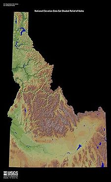
 Idaho is a landlocked state in the northwestern U.S.. It was admitted as the 43rd state of the Union on July 3, 1890. It is mountainous state in the Pacific Northwest.
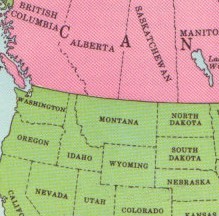
Idaho has in the North a boundary with the Canadian province of British Columbia that follows the 49th parallel of latitude. Its southern border with Utah and Nevada follows the 42nd parallel. The state's northeastern border is with Montana and the eastern border with Wyoming incorporates a small slice of Yellowstone National Park. On the west Idaho borders Oregon and Washington (U.S. state). Idaho's surface is 83,564 square miles (216,432 square kilometers). According to the United States Census Bureau[1] in July 2008 the population for Idaho was estimated to be 1,523,816.
Boise is the capital of Idaho.
See also[edit]
References[edit]
↧ Download as ZWI file | Last modified: 09/04/2023 17:04:43 | 8 views
☰ Source: https://citizendium.org/wiki/Idaho_(U.S._state) | License: CC BY-SA 3.0
 ZWI signed:

 KSF
KSF