Mount Hakodate
 From Handwiki
 Short description: Mountain in Hokkaido, Japan
| Mount Hakodate | |
|---|---|
| 函館山 | |
 Mount Hakodate (July 2012) | |
| Highest point | |
| Elevation | 334 m (1,096 ft) [1] |
| Listing | List of mountains and hills of Japan by height |
| Coordinates | [ ⚑ ] : 41°45′32″N 140°42′16″E / 41.75889°N 140.70444°E [1] |
| Naming | |
| Language of name | Japanese |
| Geography | |
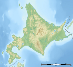 Mount Hakodate Location of Mount Hakodate in Hokkaidō. | |
| Location | Hokkaidō, Japan |
| Parent range | Oshima Peninsula |
| Topo map | Geographical Survey Institute 25000:1 函館 50000:1 函館 |
| Climbing | |
| Easiest route | Mount Hakodate Ropeway |
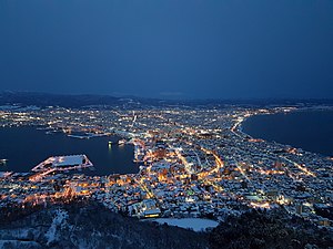
View of Hakodate city from Mount Hakodate
Mount Hakodate (函館山 Hakodate-yama) is an inactive volcanic[2] mountain in Hakodate, Hokkaidō, Japan .
The mountain is renowned for its view of the surrounding bay and city. The Michelin Green Guide: Japan gave the experience 3/3 stars in a review, placing it as equal to mountain views of Naples and Hong Kong.[3] The peak is accessible by hiking or by bike, as well as by a regular cable car service.
Geology
Mount Hakodate is a volcanic mountain that was once separate from the mainland. Around 3,000 years ago, a sandbar connected the island to mainland Hokkaido, creating an isthmus called a tombolo on which downtown Hakodate is now located. The sandbar makes Mount Hakodate a tied island.[4]
See also
- Mount Hakodate Ropeway
References
- ↑ 1.0 1.1 Geospatial Information Authority topographic map 函館
- ↑ "Global Volcanism Program | Hakodateyama". https://volcano.si.edu/volcano.cfm?vn=285801.
- ↑ "The Night View from Mt. Hakodate | Top7 Must-See Hakodate | Travel Hakodate". Archived from the original on 2014-10-19. https://web.archive.org/web/20141019172300/http://www.hakodate.travel/en/things-to-do/top7/night-view/. Retrieved 2014-07-21.
- ↑ "History - About Hakodate". City of Hakodate. 2021. https://www.hakodate.travel/en/about/history.html#:~:text=**-,Mt.,in the middle, was completed..
External links
- Hakodate Yama - Geological Survey of Japan
| Wikimedia Commons has media related to Mount Hakodate. |
 |  |
Categories: [Pleistocene volcanoes] [Stratovolcanoes]
↧ Download as ZWI file | Last modified: 12/17/2023 04:50:37 | 3 views
☰ Source: https://handwiki.org/wiki/Earth:Mount_Hakodate | License: CC BY-SA 3.0
 ZWI signed:
ZWI viewer
by the  KSF
KSF