Devils Paw
 From Handwiki
 | Devils Paw | |
|---|---|
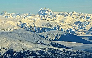 Aerial view from the south | |
| Highest point | |
| Elevation | 8,584 ft (2,616 m) |
| Prominence | 5,686 ft (1,733 m) [1] |
| Listing |
|
| Coordinates | [ ⚑ ] : 58°43′51″N 133°50′23″W / 58.73083°N 133.83972°W |
| Geography | |
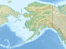 Devils Paw Location in Alaska (on border with British Columbia) 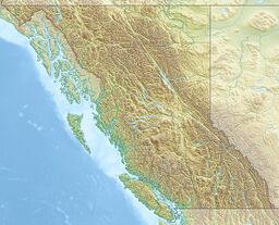 Devils Paw Devils Paw (British Columbia) | |
| Location | Juneau City and Borough, Alaska, U.S. / Stikine Region, British Columbia, Canada |
| Parent range | Juneau Icefield / Boundary Ranges |
| Topo map | NTS Script error: No such module "Canada NTS". |
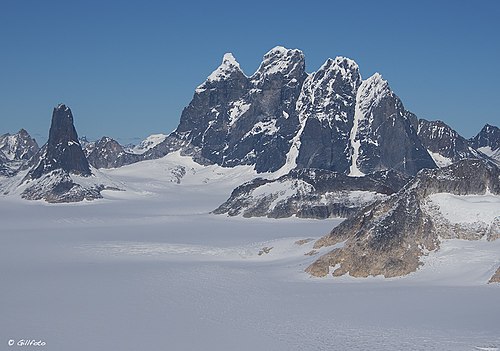
Devils Paw (or Devil's Paw, or Boundary Peak 93) is the high point of the Juneau Icefield, on the Alaska-British Columbia border. It is a part of the Boundary Ranges of the Coast Mountains. It is notable for its steep rise above the low local terrain. Its height is sometimes given as 8,507 feet (2,593 m)[2].
Devils Paw is located on the northeast side of the Juneau Icefield, and its north slopes feed Tulsequah Lake and the Tulsequah Glacier. Its south slope forms the head of the picturesquely-named "Hades Highway", which is the eastern extremity of the Icefield.
To illustrate the steepness of the peak: the north face drops 7,000 ft (2,130 m) in approximately three miles (4.8 km), and the southeast side drops 8,000 ft (2,440 m) in about seven miles (11.3 km).
Climate
Based on the Köppen climate classification, Devils Paw is located in a subpolar oceanic climate zone, with long, cold, snowy winters, and cool summers.[1] Temperatures can drop below −20 °C with wind chill factors below −30 °C.
See also
- List of mountain peaks of North America
- List of mountain peaks of Canada
- List of mountain peaks of the United States
References
- ↑ Peel, M. C.; Finlayson, B. L.; McMahon, T. A. (2007). "Updated world map of the Köppen−Geiger climate classification". Hydrol. Earth Syst. Sci. 11. ISSN 1027-5606.
- ^ If the height is actually 8,507 feet (2,593 m) then the prominence is reduced to 5,610 feet (1,710 m).
- ^ E.g. "Canadian Mountain Encyclopedia". http://bivouac.com/MtnPg.asp?MtnId=3119.
Sources
- Devils Paw on Topozone
External links
- Devils Paw weather: Mountain-Forecast.com
- Picture of Devil's Paw from Mt. Moore
Juneau (capital) | ||
| Topics |
|  |
| Society |
| |
| Regions |
| |
| Largest cities pop. over 25,000 |
| |
| Smaller cities pop. over 2,000 |
| |
| Boroughs |
| |
| Native Corporations |
| |
| Census Areas |
| |
Template:Topics on British Columbia
 |  |
Categories: [Mountains of Alaska]
↧ Download as ZWI file | Last modified: 11/08/2023 12:13:38 | 14 views
☰ Source: https://handwiki.org/wiki/Earth:Devils_Paw | License: CC BY-SA 3.0
 ZWI signed: