Faranah
 From Handwiki
 Faranah | |
|---|---|
Sub-prefecture and town | |
| Nickname(s): Sankaran | |
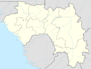 Faranah Location in Guinea | |
| Coordinates: [ ⚑ ] 10°02′N 10°44′W / 10.033°N 10.733°W | |
| Country | |
| Region | Faranah Region |
| Elevation | 456 m (1,496 ft) |
| Population (2014 census) | |
| • Total | 78,108 |
Faranah (N’ko: ߝߙߊߣߊ߫߫) is a town and sub-prefecture in central Guinea, lying by the River Niger. As of 2014 it had a population of 78,108 people.[1] The town is mainly inhabited by the Malinke people.
History
Sékou Touré was born in what was then a village, and after becoming president developed it with a mosque, palace and conference centre. It lies immediately south west of the Haut Niger National Park. The town is served by Faranah Airport.
Climate
Faranah has a tropical savanna climate (Köppen climate classification Aw).
Script error: No such module "weather box".
Mining
Faranah is near major iron ore deposits.
Notable residents
- Mamadou Barry - Olympic Guinean long-distance runner
Singer Sayon Camara, artist of Dinuiraye
References
- ↑ "Guinea". Institut National de la Statistique, Guinea, accessed via Geohive. http://www.geohive.com/cntry/guinea.aspx.
- ↑ "World Meteorological Organization Climate Normals for 1991-2020 — Faranah". National Oceanic and Atmospheric Administration. https://www.nodc.noaa.gov/archive/arc0216/0253808/2.2/data/0-data/Region-1-WMO-Normals-9120/Guinea/CSV/FARANAH_61833.csv.
- ↑ "Faranah Climate Normals 1961–1990". National Oceanic and Atmospheric Administration. ftp://ftp.atdd.noaa.gov/pub/GCOS/WMO-Normals/TABLES/REG__I/GW/61833.TXT. Retrieved July 6, 2015.
[ ⚑ ] 10°02′N 10°44′W / 10.033°N 10.733°W
 |  |
Categories: [Regional capitals in Guinea]
↧ Download as ZWI file | Last modified: 07/25/2024 12:53:40 | 2 views
☰ Source: https://handwiki.org/wiki/Place:Faranah | License: CC BY-SA 3.0
✘
ZWI is not signed. [what is this?]
ZWI viewer
by the  KSF
KSF